Back to ExploreNARL Rayleigh/Mie Lidar
Instrument
NARL Rayleigh/Mie Lidar
National Atmospheric Research Laboratory Rayleigh/Mie Lidar
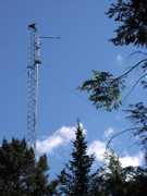
The Rayleigh/Mie Lidar is a ground-based lidar operated by the National Atmospheric Research Laboratory (NARL) in Gadanki, India. It uses two channels: one for Mie scattering and another for Rayleigh scattering. These measurements help derive cloud properties, aerosol characteristics, and temperature profiles. It operates at a wavelength of 532 nm with a pulse repetition frequency of 50 Hz. It has a spatial resolution of 300 m and a temporal resolution of 4 minutes.

Instrument Details
- Lidar
- Earth Science > Spectral/engineering > Lidar > Lidar BackscatterEarth Science > Spectral/engineering > LidarEarth Science > Atmosphere > CloudsEarth Science > Atmosphere > Clouds > Cloud PropertiesEarth Science > Atmosphere > Atmospheric Temperature > Upper Air Temperature > Vertical ProfilesEarth Science > Atmosphere > AerosolsEarth Science > Atmosphere > Aerosols > Aerosol BackscatterEarth Science > Atmosphere > Atmospheric TemperatureEarth Science > Atmosphere > Clouds > Tropospheric/high-level Clouds (observed/analyzed) > Cirrus/systems > Cirrus Cloud Systems
- Full Column Profile
- 4 min
- 300 m
- 563.5 THz
- Currently unavailable
Currently unavailable
Currently unavailable
Currently unavailable
Currently unavailable
Currently unavailable
data center outside NASA
 Permanent Land Site Stationary 63 Campaigns · 100 Instruments |  Balloon Measurements of the Asian Tropopause Aerosol Layer 2014—2017 India, Saudi Arabia 4 Deployments · 0 Data Products
|